Local Government
East Pilbara
Region
Pilbara
Chinaman Creek 5km West of Marble Bar
Covering an area of 1.4 Kms on the south bank of Chinaman Creek. Located 5km west of Marble Bar. De Grey Land District - Sheet 2855 Edition 1, Australia Topographic Map Series, and is a square bounded by AGM coordinates 779500 7656500; 780500 7656500; 780500 7655500; 779500 7655500.
East Pilbara
Pilbara
| Type | Status | Date | Documents |
|---|---|---|---|
| (no listings) |
| Type | Status | Date | Documents |
|---|---|---|---|
| (no listings) |
| Type | Status | Date | Grading/Management | |
|---|---|---|---|---|
| Category | ||||
| Classified by the National Trust | Classified {Lscpe} | 01 Jun 1995 | ||
| Aboriginal Heritage Sites Register | Registered | |||
| Register of the National Estate | Indicative Place | |||
04443 Marble Bar & Chinaman's Pool
Geological monument
| Epoch | General | Specific |
|---|---|---|
| Original Use | OTHER | Other |
| General | Specific |
|---|---|
| SOCIAL & CIVIC ACTIVITIES | Environmental awareness |
| DEMOGRAPHIC SETTLEMENT & MOBILITY | Exploration & surveying |
| SOCIAL & CIVIC ACTIVITIES | Education & science |
This information is provided voluntarily as a public service. The information provided is made available in good faith and is derived from sources believed to be reliable and accurate. However, the information is provided solely on the basis that readers will be responsible for making their own assessment of the matters discussed herein and are advised to verify all relevant representations, statements and information.
55km South-East of Telfer Catchment of Rudall & Lake Dora
East Pilbara
Pilbara
| Type | Status | Date | Documents |
|---|---|---|---|
| (no listings) |
| Type | Status | Date | Documents |
|---|---|---|---|
| (no listings) |
| Type | Status | Date | Grading/Management | |
|---|---|---|---|---|
| Category | ||||
| Register of the National Estate | Registered | 21 Mar 1978 | ||
Landscape
| Epoch | General | Specific |
|---|---|---|
| Original Use | PARK\RESERVE | Park\Reserve |
| General | Specific |
|---|---|
| DEMOGRAPHIC SETTLEMENT & MOBILITY | Aboriginal Occupation |
This information is provided voluntarily as a public service. The information provided is made available in good faith and is derived from sources believed to be reliable and accurate. However, the information is provided solely on the basis that readers will be responsible for making their own assessment of the matters discussed herein and are advised to verify all relevant representations, statements and information.
East Pilbara
East Pilbara
Pilbara
| Type | Status | Date | Documents |
|---|---|---|---|
| (no listings) |
| Type | Status | Date | Documents |
|---|---|---|---|
| RHP - To be assessed | Current | 25 Jul 2014 |
| Type | Status | Date | Grading/Management | |
|---|---|---|---|---|
| Category | ||||
| (no listings) | ||||
The place is a rare example of contact period rock art created by a European in the Pilbara region, Western Australia and Australia located within a site that is highly valued by the national and international community of rock art specialists, academics, and heritage professionals.
Abydos-Woodstock has significance as a site where Indigenous people were employed to work on the pastoral land, and thus shows interactions between white settlers and traditional owners of the land. The engraving within the larger significant place provides an additional aspect to understanding these relationships, suggesting as it does that non-Indigenous people were present in this location much earlier than previously supposed. The place has considerable importance to the understanding of the history of the region and European settlement of Western Australia.
Study of the place has the potential to refine or develop scientific dating techniques regarding rock art in the Pilbara, Western Australia, Australia and the world as a research site. It has considerable potential to yield information regarding human occupation in Australia.
The place is a rare example of contact period rock art created by a European in the Pilbara region, Western Australia and Australia. It is located within a site is highly valued by the national and international community of rock art specialists, academics, and heritage professionals. The place has the potential to refine or develop scientific dating techniques regarding rock art in the Pilbara, Western Australia, Australia and the world as a research site. It has considerable potential to yield information regarding human occupation in Australia.
The place is located adjacent to BHP Mt Newman railway line amidst a series of dated inscriptions across a large granite boulder. Within this group, is an additional panel which includes four petroglyph motifs, including the apparent date '1771' and the letter 'H'. The 'H' is located above an anthropomorphic figure. A circular shape with lines radiating from the centre is also located within the group, located above the date. The circular figure and the 'H' appear to have been engraved on the surface of the boulder with a metal edged tool, similar to a knife blade, and a stone hammerstone. The numerals and figure have been created with a stone hammer.
The attribution of the 1771 Engraving to a European in the year 1771 raises several potential questions regarding how the artist made their way from the coast approximately 200 kilometres upriver to the interior of Australia. Although, Dutch, British, French and Portuguese sailing vessels reportedly sailed within the vicinity of the northern and western coasts of Australia during in the late 1600s on, there does not appear to be any other evidence of European presence in the area or along the coast around this period.
Historic Site
| Epoch | General | Specific |
|---|---|---|
| Present Use | PARK\RESERVE | Park\Reserve |
| General | Specific |
|---|---|
| PEOPLE | Early settlers |
| DEMOGRAPHIC SETTLEMENT & MOBILITY | Racial contact & interaction |
| DEMOGRAPHIC SETTLEMENT & MOBILITY | Exploration & surveying |
This information is provided voluntarily as a public service. The information provided is made available in good faith and is derived from sources believed to be reliable and accurate. However, the information is provided solely on the basis that readers will be responsible for making their own assessment of the matters discussed herein and are advised to verify all relevant representations, statements and information.
Salgash Corunna Downs Rd East Pilbara
Approx 40kms south of Marble Bar
Brockman's Station (1890s)
East Pilbara
Pilbara
| Type | Status | Date | Documents |
|---|---|---|---|
| (no listings) |
| Type | Status | Date | Documents |
|---|---|---|---|
| (no listings) |
| Type | Status | Date | Grading/Management | |
|---|---|---|---|---|
| Category | ||||
| Municipal Inventory | Adopted | 27 Aug 1999 | ||
03695 Corunna Downs Station & Former Wartime Airbase
Individual Building or Group
| Epoch | General | Specific |
|---|---|---|
| Original Use | FARMING\PASTORAL | Homestead |
| Style |
|---|
| Federation Bungalow |
| Type | General | Specific |
|---|---|---|
| Roof | METAL | Corrugated Iron |
| General | Specific |
|---|---|
| OCCUPATIONS | Grazing, pastoralism & dairying |
This information is provided voluntarily as a public service. The information provided is made available in good faith and is derived from sources believed to be reliable and accurate. However, the information is provided solely on the basis that readers will be responsible for making their own assessment of the matters discussed herein and are advised to verify all relevant representations, statements and information.
Corunna Downs is associated with pioneer families notably the Drake- Brockmans and the Foulkes Taylors and the group of buildings on it illustrate the high degree of development reached in its administration. Few other houses built from ant bed remain in the north and the property has additional interest in more recent years as a_ bomber base during World War II.
The homestead consists of a kitchen block and separate bedroom and living block of ant bed walls and concrete floor. The original roof has been replaced with a steel framed roof structure which spans cl ear over the verandahs and rooms leaving the walls free standing beneath. The roof is sheeted with corrugated galvanized iron. _ The plan consists of a large living room and a bedroom opening onto verandahs each side of the long axis with rooms under the verandah roof each end. The ceilings are level at wall plate height and ripple iron lined in the centre core. The rooms und er the verandah roof are faked ripple iron or stamped metal lined. The separate kitchen block has concrete walls and corrugated iron roof. The outbuildings are of no great interest and some of the earlier outbuildings have long been destroyed.
Assessment 1983 Construction: c 1890 Corunna Downs was owned for long periods firstly by A.H. & G.D. Drake-Brockman (1891- 1927)and secondly by Ernest Foulkes Taylor (1927-1951) who is buried in the station graveyard. It was described in 1915 as better equipped than any other station in the north-west . The main house was built of ant bed bricks in the 1890's. During World War II, two 7,000 foot runways for Liberator and Wellington bombers were put down on the run some distance from the homestead . The Japanese despite many attempts, failed to locate this base. Old machinery remains at the various early mining sites on the property.
This information is provided voluntarily as a public service. The information provided is made available in good faith and is derived from sources believed to be reliable and accurate. However, the information is provided solely on the basis that readers will be responsible for making their own assessment of the matters discussed herein and are advised to verify all relevant representations, statements and information.
Constructed from 1897, Constructed from 1942
Corunna Downs Homestead (1897) has aesthetic and historic significance. It demonstrates a distinctive way of life in the Pilbara. and has scarcity value. The house, built of 'anthill' brick and granite, was distinguished among north-west station homes for its comfort and modern equipment. It was built with a view to permanency and comfort and has survived. It is a tribute to its builders, the Drake-Brockman family, who had pioneered the station property in 1890. and established a lifestyle of homes and gardens in a manner unexpected in the early days of the inland Pilbara. Comma Downs Homestead group has been classified by the National Trust, and is on the Register of the National Estate.
The setting of Comnna Downs Station is mainly undulating plain surrounded by hills which make a good natural boundary. This homestead site was chosen in 1897 following several previous unsatisfactory sites. The homestead is a complex of buildings dating from this time.." The original one being constructed of local 'anthill' brick and granite, with foundations of granite. ...A most comfortable habitation of the semibungalow type". Another homestead, built in 1903 and many outbuildings added over the years make up the present complex (kitchen, laundry and kitchen block, butcher's shop, workshop, spinifex bough sheds etc). Date palms are relics from its previous splendid gardens.
| Ref ID No | Ref Name | Ref Source | Ref Date |
|---|---|---|---|
| Battye; "The History of North West Australia". p193-195 | |||
| K Mallet; "To the Bar Bonded". |
This information is provided voluntarily as a public service. The information provided is made available in good faith and is derived from sources believed to be reliable and accurate. However, the information is provided solely on the basis that readers will be responsible for making their own assessment of the matters discussed herein and are advised to verify all relevant representations, statements and information.
Salgash Corunna Downs Rd East Pilbara
Approx 40kms south of Marble Bar
Brockman's Station (1890s)
East Pilbara
Pilbara
Constructed from 1897, Constructed from 1942
| Type | Status | Date | Documents |
|---|---|---|---|
| State Register | Registered | 30 Mar 2007 | HCWebsite.Listing+ListingDocument, HCWebsite.Listing+ListingDocument |
| Type | Status | Date | Documents |
|---|---|---|---|
| (no listings) |
| Type | Status | Date | Grading/Management | |
|---|---|---|---|---|
| Category | ||||
| Classified by the National Trust | Classified | 07 Jun 1983 | ||
| Register of the National Estate | Nominated | 15 Oct 1984 | ||
| Register of the National Estate | Indicative Place | |||
| Library Id | Title | Medium | Year Of Publication |
|---|---|---|---|
| 11951 | Black Swans over Java | Book | 2021 |
| 7211 | Images CD No. 36 : assessment images : Church of St Mary Star of the Sea Group, Carnarvon; Poinciana House, Marble Bar; Corunna Downs Station & Wartime Airbase; Gascoyne Research Station, Carnarvon. | C D Rom | 2004 |
Individual Building or Group
| Epoch | General | Specific |
|---|---|---|
| Other Use | MILITARY | Other |
| Other Use | Transport\Communications | Air: Other |
| Present Use | FARMING\PASTORAL | Homestead |
| Original Use | FARMING\PASTORAL | Homestead |
| Style |
|---|
| Federation Bungalow |
| Type | General | Specific |
|---|---|---|
| Wall | CONCRETE | Other Concrete |
| Wall | EARTH | Other Earth |
| Wall | METAL | Corrugated Iron |
| Wall | STONE | Granite |
| Roof | METAL | Corrugated Iron |
| General | Specific |
|---|---|
| DEMOGRAPHIC SETTLEMENT & MOBILITY | Workers {incl. Aboriginal, convict} |
| OCCUPATIONS | Grazing, pastoralism & dairying |
| OUTSIDE INFLUENCES | World Wars & other wars |
This information is provided voluntarily as a public service. The information provided is made available in good faith and is derived from sources believed to be reliable and accurate. However, the information is provided solely on the basis that readers will be responsible for making their own assessment of the matters discussed herein and are advised to verify all relevant representations, statements and information.
Wittenoom Rd East Pilbara
East Pilbara
Pilbara
| Type | Status | Date | Documents |
|---|---|---|---|
| (no listings) |
| Type | Status | Date | Documents |
|---|---|---|---|
| RHP - To be assessed | Current | 28 Jul 2006 |
| Type | Status | Date | Grading/Management | |
|---|---|---|---|---|
| Category | ||||
| Register of the National Estate | Registered | 21 Oct 1980 | ||
Abydos-Woodstock Government Research Station has historic significance as the site of discoveries which have enabled continued farming in the Pilbara
Abydos and Woodstock have significance as sites of failed pastoralism, before the Government Research Station findings
Woodstock Station Homestead has significance for the quality of the stone construction in the earliest buildings
Woodstock Homestead was one of the earliest buildings in the area, and demonstrates an earlier way of life, first as a wayside pub and later as a station homestead
Woodstock Homestead has historic links to the wagon route to the Tambourah goldfield
Abydos-Woodstock has significance as the site of many scientists conducting research into diverse areas, including agriculture, botany, geology, archaeology and zoology
Abydos-Woodstock has significance as a site where Indigenous people were employed to work on the pastoral land, and thus show interactions between white settlers and traditional owners of the land
The site complex on the Abydos-Woodstock Reserves is part of one of the richest rock art centres of the worlds. Site components include engravings, painting, grinding patches, gnamma holes and artefacts. The petroglyphs may be the oldest rock art in Australia, and are potentially the world's largest surviving collection of Ice Age art
Woodstock 65B has strong contemporary social value via the retention and rejuvenation of Aboriginal connections and is highly valued by those who have authority to speak for the place, and other Indigenous communities. It has significance as an important site for Indigenous people, both past and present, who have lived and worked on and around Woodstock Station and Abydos Station. This importance is reflected in the number of traditions, beliefs and songs associated with the engravings
The petroglyphs are of high research value, having been created over a long and continual timeframe, and their content has the potential to contribute to a wider understanding of the cultural and natural history of WA, including its prehistory
The site has the potential to contribute to the understanding of the pattern of human occupation of WA potentially dating back 26 000 years
The site is highly valued by the national and international community of rock art specialists, academics, and heritage professionals
Woodstock Homestead was built in three stages. The earliest stage dating from 1883-84 has granite walls now pointed in an embossed cement pointing. The stone central core is completely surrounded by verandas, the western side of which, adjoining the veranda of the later kitchen (dating from c.1914), is enclosed. The roof is hipped with vented gables. Immediately to the west stands the kitchen block also of granite with a similar roof but on an opposing axis. To the south is a newer wing. The whole of the roof sheeting has been replaced with recent corrugated iron sheeting. Abydos Homestead (1882, 1937-38) Comprises a large sitting room, dining room and bedroom opening onto wide surrounding verandas, fitted with substantial shutters. The original galvanised iron kitchen remains, as do two sleeping rooms. The house is constructed of asbestos on a timber frame and has a replica of the 1882 domed iron roof. Woodstock 65B Petroglyphs Woodstock site 65B is located near the abandoned Abydos Homestead. It is a granite conical boulder pile, rising about 80 m above the surrounding plain. It bears an estimated 2 000 petroglyphs, which are scattered in several concentrations around its slopes, with a notable occurrence of very elaborate and detailed human figures found near the summit. Large boulders form a distinctive shoulder on the western slope, creating an area of level ground where petroglyphs of very different ages occur in close proximity, even on the same panels.
Aboriginal population known, reflecting the settlers’ indifference to Aboriginal culture and society and the resultant dislocation of surviving traditional Aboriginal landowners, many of whom became stockmen, domestic servants or pearlers. Although Abydos Plain has a broad homogeneity in its physical features, its coastal areas are more amenable to human intervention, as are the coastal plains to its south. Hence, the surveyor, F.T. Gregory, seeking grazing lands in the Northwest in 1861, recommended the country between the Ashburton and De Grey Rivers for ‘judicious’ settlement. Reports of pearls around Nickol Bay were an added enticement. New arrivals flooded in, many already equipped with the necessary skills and stock. W. Padbury and his manager C. Nairn settled on the De Grey River in 1865, while J. Withnell and O. Wellard selected stations on the Harding. Ships brought settlers, sheep, cattle and horses, some of them from Victoria through the port now known as Cossack. In 1866, an overland stock route linked Geraldton with the newly proclaimed town of Roebourne. By 1867, pastoral development encompassed 61 land grants totalling 5.8m acres. Aboriginal stockmen shepherded the stock and provided labour for the booming pearling industry, which supplemented many pastoralists’ incomes. In 1934, sheep numbers peaked at 1 807 800 through graziers’ efforts to increase stock to compensate for falling wool prices. Numbers declined by more than half during the next twelve years through mismanagement and over-grazing. When, from 1969 onwards, wool prices dropped, a change from sheep to cattle occurred until, by the 1980s, cattle numbers exceeded those of sheep. During the 1969-72 recession, many stations changed hands, a number being acquired by Aboriginal groups. Woodstock (Reserve 22627) and Abydos (Reserve 22626), now comprising 150 000ha, are 150km south of Port Hedland, between the De Grey plains to the north and the Chichester Range to the south. The area is dissected from north to south by two major routes: the Port Hedland-Wittenoom Highway and the Port-Hedland-Newman ore-carrying railway and its adjacent service road. From the highway, a road to Marble Bar runs past Woodstock Station Homestead, where there is an airstrip for the Flying Doctor Service. There were six successive phases in the occupation of the Abydos-Woodstock Reserves: Aboriginal, public house, pastoral, agricultural research, museum vestment, and Aboriginal Reserve. The Aboriginal inhabitants of the first phase were probably Kariera speakers, with some Indjibani speakers on the southwestern borders. Countless petroglyphs, grinding patches and occupation sites throughout the area bear witness to their rich cultural life. In the second phases, 1893-1910, a public house at Woodstock catered for prospectors and miners. During this period, c.1899, the pastoral period began on Woodstock with additional leases being granted. Abydos was a pastoral property from its inception in 1882. 1945 marked the collapse of pastoralism and the departure of the graziers from the Abydos-Woodstock Reserves. Controlled by the Department of Agriculture, 30 years of pastoral research commenced. Awareness of the wealth of Aboriginal engravings gradually dawned on Europeans from the late 1930s. After the Department of Agriculture withdrew in 1976, both stations were vested in the Trustees of the West Australian Museum, where they were utilised as Reserves from the study of Aboriginal culture, material, historic buildings and grazing. Abydos-Woodstock Reserves was one of the first Aboriginal site complexes to be entered in the Register of the National Estate by the Australian Heritage Commission. The Aboriginal community from neighbouring Yandeearra Station have informal cattle grazing rights, and Aboriginal people claiming a genuine interest have freedom of access to their cultural sites. Woodstock Station Homestead Woodstock Station Homestead (1883-84) was one of several wayside pubs on the old wagon route from Cossack-Roebourne to the Tambourah goldfield. Others were at Mallina (1881) and Yandeearra (1882). The Tambourah goldfield (1883) had at one stage 500-600 men working, three pubs and a Post Office connected by telephone to Marble Bar. Billy Look (or Looke) held the first licence at Woodstock, previously owning Lalla Rookh Station to the north. Initially intending to establish a sheep station, he was prompted by the gold finds at Tambourah to build Woodstock as a public house instead. He employed a skilled stonemason, Edwards, to construct the property from granite quarried from one main dome 1.5km away. Edwards had previously built Williambury on the Gascoyne. Soon after completion of Woodstock Homestead, Edwards committed suicide. The original building comprised only two large rooms, with a wide veranda and separate kitchen. Additions (possibly 1898), evidence 50cm thick walls, a bedroom opening onto the front veranda facing Coorong Creek, a bar room (6m by 4m) in the middle of the house, and smaller room opening onto the bar room. Adjacent and opening onto the back veranda was a kitchen and cook’s room of stone. Until the 1960s the road ran between Coorong Creek and the house. Travellers’ accommodation was a galvanised iron shanty of three or four rooms with wooden shuttered windows on a rise, some 80m from the homestead. Life at Woodstock Inn has been described as follows: No women were on this place… Guests, staff and owner were invariably in drunken stupors, thanks to the practice of keeping and freely dispensing only [overproof] rum. Cash was scarce and gold dust, which was plentiful, was the common currency. Not only did the inn provide for prospectors and miners, but for police, recruiters of Aboriginal labour and their unfortunate victims, and on one occasion, for a party of 23 pseudo-explorers and their two tons of special provisions. At some stage a Post Office, whose foundations are still visible, was built adjacent to Woodstock Inn and telegraph link to Whim Creek existed. Look left Woodstock by 1898, to be replaced by Fred Prentice who advertised ‘enlarged and renovated hostelry’, with attractions including fresh vegetables and meat. However, his stay was short, since by December that year the lease was held by Billy Pead. It is unclear when Woodstock ceased operating as an inn, but as Tambourah’s alluvial gold declined Pead stayed on as an accountant while his wife worked the station until 1910. Transfer of the lease occurred several times in the early 1900s, until Percy Draper and Ronald Parker took over in partnership in 1913/14. They added a large stone drawing room to the homestead, using the existing veranda as a breezeway, and a kitchen block, both probably 1914. The difference in quality of the stonework from the fine original is obvious. Parker managed Woodstock employing an accountant-overseer, a white stockman, a Chinese cook, Aboriginal stockmen and house-girls and an Irish housekeeper. At this time, Woodstock was the mail depot for the surrounding area and people came in once a month for letters and goods from the large station store. Various land transfers took place over the subsequent years, so by 1929 Woodstock amounted to 267 486 acres. Conditions in the late 1930s were recalled as follows: There were usually four or five white men; two or three stockmen, an overseer and two jackaroos – it varied. A jackaroo was paid £2/10 with all found. This was quite generous for those days. Jimmy Todd was a fencing contractor. The Aboriginal labour lived at Coorong Creek, camping. There were about forty to fifty in the whole bunch – it depended on the season. We didn’t employ all of course, but there’d be a good dozen working for us when we were busy. They got their food, clothes and rations from the station. They earned some money, and the working men usually bought their own clothes. The Aborigines were never a permanent population. There weren’t any ‘originals’ among them; they were mainly mixed race… not that many full bloods. As elsewhere in the Pilbara, from the mid-1930s, Woodstock deteriorated and in 1945 it was foreclosed, and the Drapers forced to leave. Neighbouring Yandeearra, Kangan and Abydos met the same fate. A finale to pastoralism on Woodstock was the destruction of the homestead roof and the substantial shearing shed by a summer cyclone in 1945. Abydos Homestead In 1880, 62 000 acres of land was demarcated as two leases in the area later known as Abydos. Frederick Arundel Wedge leased this land from 1887 until sometime before 1893. He also took up considerable property around the Turner and De Grey Rivers, including Tabba Tabba and Wallareenya Hill. He is remembered today by a street named after him in Port Hedland. The next available record (1892) shows Dalgetys as lessees of the same area and an adjacent 20 000 acres to the west. Occupants to 1919 were the Hester family. They sold the station to brothers Clem and Fred Leeds as a going concern. Fred Leeds’ daughter, Mary, recalled life on Abydos from her birth there in 1929 to their departure in 1945: The spring provided plenty of excellent water. We kept three milking cows and enough cattle for our own meat supplies. Father used to take us to ‘Wall Street’, two high walls of stone near our home. He used to shoot plenty of kangaroos there to supplement our beef. We kept out butter, milk, meat and eggs in an early-style cooler, using charcoal and water… and we salted beef. Abydos had a large vegetable garden edged with oleander trees around the house. Apart from the Leeds brothers, the household comprised Fred’s wife and daughter, a mixed-descent child called Nancy, who was brought up with Mary, and Una Parker, an Aboriginal Woman. Una was both house-girl and friend to Mary until she left Abydos. Station employees included a white overseer and mainly mixed-descent stockmen from other areas. Most of the Aboriginal people spoke English and all of them returned to some kind of traditional bush life for three months during the summer. Mary Leeds remembers one occasion when a young boy was initiated at Abydos. This may have been at Stinking Pool, a ceremonial site near the station’s northern border. The original homestead was built about 1882 when Wedge’s claims were accepted. Like Woodstock, the walls were of granite and mud and plastered over inside. Both house and adjacent separate kitchen had high domed iron roofs for coolness. There were two separate sleeping rooms near the house, with elegant walls of pressed metal, whose date of construction is unknown, as well as other outbuildings. Around 1937-8, the Leeds built a new homestead on the foundation of the old and to the same plan: large sitting room, dining room and bedroom opening onto wide surrounding verandas. The family slept on the verandas, which were later fitted with substantial shutters. The original galvanised iron kitchen remained, as did two sleeping rooms. The new house was asbestos on a timber frame and with a replica of the old domed iron roof. The name Abydos is taken from the site of Aswan Dam. Since the Leeds brothers had wartime experience in Egypt, it seems likely that they named the station in 1919 and it was the extended to apply to the whole plain. By 1945, the flocks were reduced by half and Dalgetys foreclosed on Abydos. Fred Leeds gained a position as secretary to the Port Hedland Roadboard, and Clem returned to the family home in Fremantle. Abydos-Woodstock Government Research Station The widespread failure of pastoral leases in the Pilbara led to questions over the viability of the sheep industry there. The Premier, and former Minister for Agriculture, Frank Wise, caused the Government to purchase Woodstock and Abydos in 1946 as an agricultural research station. From 1946 to 1976, then, Woodstock and Abydos were under the control of the Department of Agriculture. They attracted scientists from a variety of disciplines, including agriculture, botany, geology, archaeology and zoology. Woodstock Homestead was modified to provide accommodation for such visitors. For most of this period the manager was R. Sherlock, who lived with his family in Abydos Homestead because of the cyclone damage to Woodstock in 1945. When Hank Suijdendorp, newly graduated in agricultural science from UWA, arrived at the research station in 1951 to begin work, Woodstock remained abandoned and roofless. For six months he lived at Abydos, before the PWD replaced the lost roof and Suijdendorp could bring his family up from Perth. This was to be their home for the next three years. The research station is now credited with solving the problems of the sheep industry in the Pilbara and producing sustainable management plans for pastoral stations in the area. One pastoralist recalls that ‘Abydos Station made the Pilbara!’ Suijendorp notes that ‘the important outcome is that the Pilbara is still being occupied by pastoralists who took notice of this research… the carrying capacity is still increasing and this is the only area in Australia to do so’. Vestment in WA Museum In February 1978, Woodstock and Abydos were officially invested in the Trustees of the WA Museum as Reserves for the Preservation of Aboriginal Cultural Material and Historic Buildings and Grazing. The Museum was to retain full control of the Woodstock Homestead and that area of Woodstock east of the Newman Railway Line, while leasing the western section of Woodstock and all of Abydos to the Yandeearra community for grazing purposes. Woodstock 65B Petroglyphs Scientific interest in the rock art began in 1938 when the Frobenius Institute Expedition visited Woodstock and Abydos. In 1966, with mining developments rapidly expanding the WA Museum tried to protect some areas by means of fencing, erecting notices and explaining to mine workers the need for their cooperation. Most of the granite outcrops on the Woodstock/Abydos pastoral leases and the Abydos Plain generally contain engravings. The number of motifs varies from a few simple tracks to hundreds of often complex engravings. A range of motifs has been recorded; tracks and human figures are common, but depictions of animals and weapons also occur. The human figures on the Abydos Plain are generally: long; with elongated bodies, long flowing limbs; have one or more ‘antenna’ at the back of the head; split/two-digit hands and feet; dog/kangaroo-like beaked faces; and large genitalia on the male figures. They have been dated as the oldest rock art in Australia – more than 26 000 years old. The number of petroglyph motifs in the region is believed to be over a million, making the Pilbara the world's largest surviving concentration of Ice Age art. The Pilbara carvings are the same age as cave engravings at Malangine in South Australia, and the two sites share the same distinctive art style – carvings at both sites depict multiple circles with edges that come close to each other but never intersect. According to the senior Aboriginal custodian for the Woodstock area (which lives close to the abandoned cattle station of Abydos), Mr Gordon Pontroy the petroglyphs date from ‘early days’, and ‘the different circles in the carvings show the camp places of the people up in the sky – the people who look down and see the carvings. Mr Pontroy is also familiar with songs relating to the Woodstock Petroglyphs. Although there is little specific information regarding the mythological significance of rock art, Aboriginal people generally respect them since they concern the historical and traditional past of former inhabitants, and they link into a generalised tradition of creation beliefs and symbols. A number of examples, however, within the Pilbara still have active ritual and mythological significance. Comments from Indigenous people regarding the Woodstock petroglyphs include: ‘The numerous sites of cultural significance… at Woodstock and Abydos have great tribal significance to the various tribal groups comprising the Mugarinya Community… There are many sites on the land currently being used and these sites are being cared for by community members.’ ‘We don’t know what all those carvings mean, but when we go and have a look at those places, we sometimes see things which remind us a bit of things we have in our Law today. That’s why we think those places with carvings might have been really important places for those Old People in the early days – something like a Parliament – that’s why we feel a bit uneasy in those places.’ ‘[The engravings] – a memory of what’s been going on in the real early days, when that emu and kangaroo were men. When we sing the song for that, we sing about what they did in the early times… those must have been the most important things at that time.’ It has been observed that the importance of such art lies in the celebration of Ancestors’ creation journeys and of places along the routes they took, rather than as individual pieces of art in isolation. For this reason, at least two instances are recorded of people preferring to have sites destroyed by development rather than have the rocks removed to ‘safety’. It is not that people regard the art as insignificant, but that it loses its significance out of geographical context.
| Library Id | Title | Medium | Year Of Publication |
|---|---|---|---|
| 11695 | Abydos - Woodstock Pastoral Research Station 1946 - 1976 | 1976 |
Landscape
| Epoch | General | Specific |
|---|---|---|
| Other Use | FARMING\PASTORAL | Other |
| Original Use | OTHER | Other |
| General | Specific |
|---|---|
| PEOPLE | Aboriginal people |
| OCCUPATIONS | Grazing, pastoralism & dairying |
This information is provided voluntarily as a public service. The information provided is made available in good faith and is derived from sources believed to be reliable and accurate. However, the information is provided solely on the basis that readers will be responsible for making their own assessment of the matters discussed herein and are advised to verify all relevant representations, statements and information.
Woodie Woodie Rd East Pilbara
Situated near the Nullagine River 108 miles E of Port Hedland
Warrawagine Homestead Buildings
East Pilbara
Pilbara
Constructed from 1890 to 1901
| Type | Status | Date | Documents |
|---|---|---|---|
| (no listings) |
| Type | Status | Date | Documents |
|---|---|---|---|
| (no listings) |
| Type | Status | Date | Grading/Management | |
|---|---|---|---|---|
| Category | ||||
| Municipal Inventory | Adopted | 27 Aug 1999 | ||
| Register of the National Estate | Nominated | 15 Oct 1984 | ||
| Classified by the National Trust | Classified | 07 Jun 1983 | ||
| Register of the National Estate | Indicative Place | |||
Individual Building or Group
| Epoch | General | Specific |
|---|---|---|
| Present Use | FARMING\PASTORAL | Homestead |
| Original Use | FARMING\PASTORAL | Homestead |
| Type | General | Specific |
|---|---|---|
| Wall | STONE | Other Stone |
| Roof | METAL | Corrugated Iron |
| General | Specific |
|---|---|
| DEMOGRAPHIC SETTLEMENT & MOBILITY | Settlements |
This information is provided voluntarily as a public service. The information provided is made available in good faith and is derived from sources believed to be reliable and accurate. However, the information is provided solely on the basis that readers will be responsible for making their own assessment of the matters discussed herein and are advised to verify all relevant representations, statements and information.
Constructed from 1901
Warrawagine Homestead has aesthetic and historic significance. Warrawagine was one of the original pastoral leases in the Marble Bar district and is still being operated as a pastoral lease. The current homestead is the second house built on Warrawagine. Warragine Homestead is classified by the National Trust, and is on the Register of the National Estate.
There are three major buildings on the Warragine Homestead block: the main house, the former quarters and the former store. Based on photographic evidence, the following observations can be made. The main house was built in 1901 of local stone, with walls 18" thick. Above the homestead roof is a parapet which was built to offer protection if needed. The verandah around the homestead originally had stone uprights, but these have been replaced with timber posts, and a timber gable and lattice work have been added to the front facade of the main house. A building, thought to be the former quarters, adjoins the main house. It has a hipped corrugated iron roof, with a wide verandah supported by timber posts. The stone work appears to have been rendered. The stone store is adjacent to the quarters. The stone walls have stone quoining and ochre coloured pointing. A verandah across one elevation is supported by slender metal posts. There are accounts of another building, a stone wagon shed, but there is no photographic evidence available.
| Ref ID No | Ref Name | Ref Source | Ref Date |
|---|---|---|---|
| National Trust of Australia (WA) ;"Assessment Documentation". | National Trust of Australia (WA) |
This information is provided voluntarily as a public service. The information provided is made available in good faith and is derived from sources believed to be reliable and accurate. However, the information is provided solely on the basis that readers will be responsible for making their own assessment of the matters discussed herein and are advised to verify all relevant representations, statements and information.
Located on the edge of the Great Sandy Desert Warrawagine is significant as one of the early stations connected with Grant Anderson and Edgar of De Grey Station. In the early days it was leased by A.R. Richardson (ref . Portland Pastoral Co . first established at Pyramid Station). From c. 1895 it was manag ed by Frank Thompson later of Pardoe Station. .... .. The c. 1890 early brick homestead, the 1901 stone homestead alongside the stone outbuildings demonstrate the progressive development of the station. The 1901 stone homestead is of interest for its parapet ed flat roof, originally reached by a timber staircase which was believed to be intend ed to give refuge from native attack. This was in the wake of the murder of Dr. Vines by desert natives at the neighbouring station, Braeside. The stone work and cement block quoins used in the 1901 homestead are repeated in the Black smith shop and coach house some distance from the homestead compl ex . The station once formed something of a social mecca for the surrounding district with social functions and open air picture shows for visitors and the large staff. It is also notable as the first station in the area to be connected (by pedal radio) to the Flying Doctor base in Port Hedland.
1. Old homestead - possibly dating from 1890, is a soft burnt brick cottage of two rooms with a verandah al 1 round. The roof which has been renewed in the same fashion as that previously existing is corrugated iron and hipped with lean-to verandahs. 2. Stone homestead dated 1901. The central core containing two rooms, one each side of a spacious hall, is constructed of a quartz type stone the colour of which is predominantly cream but also ranges through many shad es of brown. The walls are carried high above the lean .to verandah roofs w·hich surround the central core to form a parapet which originally enclosed a flat roof. Access to the flat roof was once provided by means of a timber staircase which stood at the north end of the building. Cement block quoins mark the door and window openings and the corners of the build ing and have flattish arches with cement blocks keyed over them. The verandahs, which were originally open all round save for a stone walled room built onto the south west corner have since been enclosed with timber framed and asbestos plank clad walls except for the verandah at the northern end.. The enclosures have area. e created room for a kitchen/dining room arid living Some 200 yards to the east stands a coach house of stone walls and gabled corrugated iron roof. The rectangular building is divided into three compartments. The central space is open at each side with a flattish arch spanning 6 metres and supported with difficulty· by a string of cement blocks keyed to the shape of the arch. Steel reinforcement has recently been install ed to hold up the key stone of the arch , Stonework over the other openings is supported with similar keyed concrete blocks for the outer thickness of the wall and timber lintels for the inner thickness. Some of the timber 1intels have rotted away causing damage to the stone work above .. 4) Blacksmith shop - this is some 150 metres to the north of the coach house. It is also a stone walled and gabled rectangular building and has one room. Inside is a forge apparently in working order .
Assessment 1983 Construction: Present house 1901, outbuildings back to 1880's Old homestead possibly dating from 1890.
This information is provided voluntarily as a public service. The information provided is made available in good faith and is derived from sources believed to be reliable and accurate. However, the information is provided solely on the basis that readers will be responsible for making their own assessment of the matters discussed herein and are advised to verify all relevant representations, statements and information.
East Streley River via Marble Bar
About 100ha, 75km west of Marble Bar.
East Pilbara
Pilbara
| Type | Status | Date | Documents |
|---|---|---|---|
| (no listings) |
| Type | Status | Date | Documents |
|---|---|---|---|
| (no listings) |
| Type | Status | Date | Grading/Management | |
|---|---|---|---|---|
| Category | ||||
| Classified by the National Trust | Classified {Lscpe} | 01 Jun 1995 | ||
| Register of the National Estate | Registered | 28 Oct 2003 | ||
Geological monument
| Epoch | General | Specific |
|---|---|---|
| Original Use | MONUMENT\CEMETERY | Monument |
| General | Specific |
|---|---|
| SOCIAL & CIVIC ACTIVITIES | Education & science |
| DEMOGRAPHIC SETTLEMENT & MOBILITY | Aboriginal Occupation |
| OUTSIDE INFLUENCES | Tourism |
This information is provided voluntarily as a public service. The information provided is made available in good faith and is derived from sources believed to be reliable and accurate. However, the information is provided solely on the basis that readers will be responsible for making their own assessment of the matters discussed herein and are advised to verify all relevant representations, statements and information.
Coongan Goldsworhty Rd Goldsworthy
East Pilbara
Pilbara
| Type | Status | Date | Documents |
|---|---|---|---|
| (no listings) |
| Type | Status | Date | Documents |
|---|---|---|---|
| (no listings) |
| Type | Status | Date | Grading/Management | |
|---|---|---|---|---|
| Category | ||||
| Register of the National Estate | Indicative Place | |||
Individual Building or Group
| Epoch | General | Specific |
|---|---|---|
| Original Use | RESIDENTIAL | Other |
| Original Use | FARMING\PASTORAL | Homestead |
This information is provided voluntarily as a public service. The information provided is made available in good faith and is derived from sources believed to be reliable and accurate. However, the information is provided solely on the basis that readers will be responsible for making their own assessment of the matters discussed herein and are advised to verify all relevant representations, statements and information.
Coongan Goldsworthy Rd Goldsworthy
East Pilbara
Pilbara
| Type | Status | Date | Documents |
|---|---|---|---|
| (no listings) |
| Type | Status | Date | Documents |
|---|---|---|---|
| (no listings) |
| Type | Status | Date | Grading/Management | |
|---|---|---|---|---|
| Category | ||||
| Register of the National Estate | Indicative Place | |||
Individual Building or Group
| Epoch | General | Specific |
|---|---|---|
| Original Use | FARMING\PASTORAL | Homestead |
| General | Specific |
|---|---|
| OCCUPATIONS | Grazing, pastoralism & dairying |
This information is provided voluntarily as a public service. The information provided is made available in good faith and is derived from sources believed to be reliable and accurate. However, the information is provided solely on the basis that readers will be responsible for making their own assessment of the matters discussed herein and are advised to verify all relevant representations, statements and information.
Great Sandy Desert via Telfer
East Pilbara
Pilbara
Constructed from 1896 to 1897
| Type | Status | Date | Documents |
|---|---|---|---|
| (no listings) |
| Type | Status | Date | Documents |
|---|---|---|---|
| (no listings) |
| Type | Status | Date | Grading/Management | |
|---|---|---|---|---|
| Category | ||||
| Register of the National Estate | Indicative Place | |||
Other Built Type
| Epoch | General | Specific |
|---|---|---|
| Original Use | Transport\Communications | Water: Other |
| Type | General | Specific |
|---|---|---|
| Wall | STONE | Limestone |
| General | Specific |
|---|---|
| DEMOGRAPHIC SETTLEMENT & MOBILITY | Exploration & surveying |
This information is provided voluntarily as a public service. The information provided is made available in good faith and is derived from sources believed to be reliable and accurate. However, the information is provided solely on the basis that readers will be responsible for making their own assessment of the matters discussed herein and are advised to verify all relevant representations, statements and information.
Jigalong
East Pilbara
Pilbara
Constructed from 2006 to 2007
| Type | Status | Date | Documents |
|---|---|---|---|
| (no listings) |
| Type | Status | Date | Documents |
|---|---|---|---|
| RHP - Does not warrant assessment | Current | 28 Sep 2012 |
| Type | Status | Date | Grading/Management | |
|---|---|---|---|---|
| Category | ||||
| (no listings) | ||||
Individual Building or Group
| Epoch | General | Specific |
|---|---|---|
| Present Use | GOVERNMENTAL | Police Station or Quarters |
| Present Use | GOVERNMENTAL | Courthouse |
| Present Use | GOVERNMENTAL | Office or Administration Bldg |
This information is provided voluntarily as a public service. The information provided is made available in good faith and is derived from sources believed to be reliable and accurate. However, the information is provided solely on the basis that readers will be responsible for making their own assessment of the matters discussed herein and are advised to verify all relevant representations, statements and information.
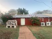
Marble Bar
East Pilbara
Pilbara
| Type | Status | Date | Documents |
|---|---|---|---|
| (no listings) |
| Type | Status | Date | Documents |
|---|---|---|---|
| (no listings) |
| Type | Status | Date | Grading/Management | |
|---|---|---|---|---|
| Category | ||||
| (no listings) | ||||
Individual Building or Group
| Epoch | General | Specific |
|---|---|---|
| Original Use | MINING | Mining Battery |
| Present Use | COMMERCIAL | Shop\Retail Store {single} |
This information is provided voluntarily as a public service. The information provided is made available in good faith and is derived from sources believed to be reliable and accurate. However, the information is provided solely on the basis that readers will be responsible for making their own assessment of the matters discussed herein and are advised to verify all relevant representations, statements and information.
Marble Bar
East Pilbara
Pilbara
| Type | Status | Date | Documents |
|---|---|---|---|
| (no listings) |
| Type | Status | Date | Documents |
|---|---|---|---|
| (no listings) |
| Type | Status | Date | Grading/Management | |
|---|---|---|---|---|
| Category | ||||
| (no listings) | ||||
Individual Building or Group
| Epoch | General | Specific |
|---|---|---|
| Present Use | HEALTH | Hospital |
| Original Use | HEALTH | Hospital |
This information is provided voluntarily as a public service. The information provided is made available in good faith and is derived from sources believed to be reliable and accurate. However, the information is provided solely on the basis that readers will be responsible for making their own assessment of the matters discussed herein and are advised to verify all relevant representations, statements and information.
Marble Bar
Part Lot 116 on DP240321
East Pilbara
Pilbara
Constructed from 1930
| Type | Status | Date | Documents |
|---|---|---|---|
| (no listings) |
| Type | Status | Date | Documents |
|---|---|---|---|
| RHP - Does not warrant assessment | Current | 10 Jan 2022 |
| Type | Status | Date | Grading/Management | |
|---|---|---|---|---|
| Category | ||||
| Classified by the National Trust | Classified | 05 Dec 1983 | ||
| Register of the National Estate | Indicative Place | |||
| Register of the National Estate | Nominated | 02 Mar 1984 | ||
The group includes a homestead, store saddle room, kitchen block, ablutions, swimming pool and other modern fixtures. There are also several fixures used for pastoral purposes, including a stockyard and storage shed. The place is currently a caravan park and tourism precinct.
Individual Building or Group
| Epoch | General | Specific |
|---|---|---|
| Original Use | FARMING\PASTORAL | Homestead |
| Present Use | FARMING\PASTORAL | Homestead |
| General | Specific |
|---|---|
| DEMOGRAPHIC SETTLEMENT & MOBILITY | Settlements |
| OCCUPATIONS | Grazing, pastoralism & dairying |
This information is provided voluntarily as a public service. The information provided is made available in good faith and is derived from sources believed to be reliable and accurate. However, the information is provided solely on the basis that readers will be responsible for making their own assessment of the matters discussed herein and are advised to verify all relevant representations, statements and information.
The roof is of one steep pitch over the verandahs and three main rooms. The roofing material is corrugated galvanised iron with storm battens fixed over the top at close centres. The walls are of concrete and stone and are approx. 450mm thick. The verandahs have tee -section posts, the steel of which bear the trademark “Frodingham England” into the sections fir top hung cyclone shutters. The ceiling height is 3670mm (12 Ft) and comes down to 2140 (7 ft) at the edge of the verandahs. The floors are of concrete. The ceilings are of plain fibrous plaster and the walls are plastered internally and rough rendered and painted externally. The kitchen block has a corrugated iron roof and walls of concrete about 100mm thick. Adjacent to the kitchen block is a store saddle room structure of Corrugated galvanised iron walls with framing of lightweight railway lines from the Port Hedland to Marble bar railway. The roof is a clear span cgi vault of some 3m. Wash house is an open galvanised iron roof structure. Cool house is an open galvanised iron roof structure. Disused toilet is an open galvanised iron roof structure. Former overseer’s quarters, now disused has an galvanised iron vaulted roof and lean-tos on each side with large open lean-to to the south containing assorted machinery and typical station junk of a mechanical nature. Motor room - galvanised iron walls and roof housing generator Hoist – steel framed structure with blocks and tackle Stockyards – timber post and rail Staff quarters - galvanised iron and framed cottage (disused) Shearer’s quarters – two galvanised iron buildings dating from 1928 Former Shearing Shed- galvanised iron structure framed in timber with 200 x 200mm posts with some very old shearing equipment (overhead pulleys) still in place. The building is very large.
Assessment 1983 Construction 1930 Architect/builder: Darby & Harry Jacoby The homestead was extended by the Thompsons in 1930. Pardoo was originally established as an outstation of the De Grey run by Seutonious Anderson, brother of A.E. Anderson who with McKenzie Grant took up Padbury’s abandoned De Grey leases in 1869. A.E. Anderson and McKenzie Grant had been members of the Portland Pastoral Co. which established Pyramid Station out of Roebourne in 1865. In 1902 the Pardoo lease was acquired by Frank Thompsonwho had been managing Warrawagine Station. The Thompsons subsequently moved to Nardlah near Broomehill but the lease remained in the family until 1963. Pardoo homestead as with De Grey homestead was close to the port of Condon which flourished from 1872 (town site called Shellborough laid out) to the late 1890’s when Port Hedland was established as the main port for the Pilbara. Condon is now abandoned and the town site of Shellborough cancelled.
This information is provided voluntarily as a public service. The information provided is made available in good faith and is derived from sources believed to be reliable and accurate. However, the information is provided solely on the basis that readers will be responsible for making their own assessment of the matters discussed herein and are advised to verify all relevant representations, statements and information.
Marble Bar
In area south of Goodabinia Reserve between Goodabinia Rd and Chinaman's Pool Rd near Magazine Pools
East Pilbara
Pilbara
| Type | Status | Date | Documents |
|---|---|---|---|
| (no listings) |
| Type | Status | Date | Documents |
|---|---|---|---|
| (no listings) |
| Type | Status | Date | Grading/Management | |
|---|---|---|---|---|
| Category | ||||
| Municipal Inventory | Adopted | 27 Aug 1999 | ||
Individual Building or Group
| Epoch | General | Specific |
|---|---|---|
| Present Use | VACANT\UNUSED | Vacant\Unused |
| Original Use | MINING | Other |
| Type | General | Specific |
|---|---|---|
| Other | CONCRETE | Other Concrete |
| General | Specific |
|---|---|
| OCCUPATIONS | Mining {incl. mineral processing} |
This information is provided voluntarily as a public service. The information provided is made available in good faith and is derived from sources believed to be reliable and accurate. However, the information is provided solely on the basis that readers will be responsible for making their own assessment of the matters discussed herein and are advised to verify all relevant representations, statements and information.
The Explosives magazine has historic and scientific heritage significance. It is associated with the mining industry, and up until the early 1980s the Magazine held mining explosives. It does not seem to have been used for army or World War II explosives. The Magazine was last used by Jimmy Jeffries. Detonators and fuses were kept in town at Jeffries' store while gelignite was kept at the Magazine.
The Magazine has been in existence at least since the 1950s. It is located near Magazine Pools, but there is no longer a really defined track leading to the Magazine. The Magazine is a corrugated iron shed with a firmlock on the door. It is surrounded by concrete block walls that were built later for extra protection. The roof of the outer shed was corrugated iron but blew off in past storms.
| Ref ID No | Ref Name | Ref Source | Ref Date |
|---|---|---|---|
| Oral history - Alf Potter, Marble Bar |
This information is provided voluntarily as a public service. The information provided is made available in good faith and is derived from sources believed to be reliable and accurate. However, the information is provided solely on the basis that readers will be responsible for making their own assessment of the matters discussed herein and are advised to verify all relevant representations, statements and information.
Marble Bar
East Pilbara
Pilbara
Constructed from 1906
| Type | Status | Date | Documents |
|---|---|---|---|
| (no listings) |
| Type | Status | Date | Documents |
|---|---|---|---|
| (no listings) |
| Type | Status | Date | Grading/Management | |
|---|---|---|---|---|
| Category | ||||
| Register of the National Estate | Nominated | 15 Oct 1984 | ||
| Classified by the National Trust | Classified | 05 Jun 1984 | ||
Individual Building or Group
| Epoch | General | Specific |
|---|---|---|
| Original Use | FARMING\PASTORAL | Homestead |
| Present Use | FARMING\PASTORAL | Homestead |
This information is provided voluntarily as a public service. The information provided is made available in good faith and is derived from sources believed to be reliable and accurate. However, the information is provided solely on the basis that readers will be responsible for making their own assessment of the matters discussed herein and are advised to verify all relevant representations, statements and information.
Yarrie station was established by Coppin while he was managing the neighbouring Muccan station for De Grey station interests and hence is important historically in the development of the area. The buildings are of some age, dating from the early 1900's and exhibit the typical features of Pilbara homesteads.
The present homestead consists of a stone building and attached corrugated iron kitchen block, a cottage of stone in cement some 30 metres away and various out buildings further afield including a shearing shed. 1) The main homestead erected early in the century is of stone construction with lime tuck-pointing outside. It consists of two rooms, one large and one smaller, separated by a 2 metre wide hall (now used as a office). This central core is surmounted by a hipped roof and is surrounded by a verandah. The roofs are corrugated iron. 2) This structure is joined at one end by a kitchen and laundry block of framed construction clad in corrugated iron. The kitchen is covered with a corrugated iron vault and the laundry section with a lean-to roof of the same material. 3) Some 30 metres away is a two roomed cottage of stone in cement mortar, originally with a pitched roof but since the 1941 blow, with a corrugated iron vaulted roof. Lean-to verandahs adorn each side of the long axis. 4) Further afield are various outbuildings of framed corrugated iron clad construction with pitched end vaulted roof. One of these structures is a shearing shed, also near at hand is a grave.
Assessment 1984 Construction 1906 onwards Builder: Coppin family After 7 years at Muccan (Cf .) Christopher Coppin took up leases of adjoining country and founded c.1890, with his sons Herbert and Christopher William, Yarrie station which is still owned by members of his family. The original old mud house was destroyed by a cyclone. A substantial stone house with wide verandahs was built in 1906, the timber for which was cut in sawpits on the station, using cadjeput (Melaleuca) said to resist white ants. Yarrie had extensive gardens for both flowers and vegetables, and old photographs show a number of date palms.
This information is provided voluntarily as a public service. The information provided is made available in good faith and is derived from sources believed to be reliable and accurate. However, the information is provided solely on the basis that readers will be responsible for making their own assessment of the matters discussed herein and are advised to verify all relevant representations, statements and information.
125km ESE from Marble Bar, Rippon Hills Rd Marble Bar
East Pilbara
Pilbara
| Type | Status | Date | Documents |
|---|---|---|---|
| (no listings) |
| Type | Status | Date | Documents |
|---|---|---|---|
| (no listings) |
| Type | Status | Date | Grading/Management | |
|---|---|---|---|---|
| Category | ||||
| Aboriginal Heritage Sites Register | Registered | |||
| Register of the National Estate | Indicative Place | |||
| Classified by the National Trust | Classified {Lscpe} | 20 Dec 1991 | ||
| Library Id | Title | Medium | Year Of Publication |
|---|---|---|---|
| 2317 | Carawine Pool : nomination of a geological monument for the register of the National Estate. | Book | 1991 |
Geological monument
| Epoch | General | Specific |
|---|---|---|
| Original Use | OTHER | Other |
| Present Use | SOCIAL\RECREATIONAL | Other |
| General | Specific |
|---|---|
| SOCIAL & CIVIC ACTIVITIES | Education & science |
| SOCIAL & CIVIC ACTIVITIES | Environmental awareness |
This information is provided voluntarily as a public service. The information provided is made available in good faith and is derived from sources believed to be reliable and accurate. However, the information is provided solely on the basis that readers will be responsible for making their own assessment of the matters discussed herein and are advised to verify all relevant representations, statements and information.
3.5km west from the town of Marble Bar Marble Bar
- Turnoff from Hillside Road
East Pilbara
Pilbara
| Type | Status | Date | Documents |
|---|---|---|---|
| (no listings) |
| Type | Status | Date | Documents |
|---|---|---|---|
| (no listings) |
| Type | Status | Date | Grading/Management | |
|---|---|---|---|---|
| Category | ||||
| Municipal Inventory | Adopted | 27 Aug 1999 | ||
| Classified by the National Trust | Classified {Lscpe} | 22 Mar 1991 | ||
| Register of the National Estate | Indicative Place | |||
| Aboriginal Heritage Sites Register | Registered | |||
| Library Id | Title | Medium | Year Of Publication |
|---|---|---|---|
| 2356 | Marble Bar and Chinaman Pool : nomination of a geological monument for the register of the National Estate. | Book | 1991 |
Geological monument
| Epoch | General | Specific |
|---|---|---|
| Original Use | OTHER | Other |
| Present Use | SOCIAL\RECREATIONAL | Other |
| General | Specific |
|---|---|
| SOCIAL & CIVIC ACTIVITIES | Sport, recreation & entertainment |
| OUTSIDE INFLUENCES | Tourism |
| DEMOGRAPHIC SETTLEMENT & MOBILITY | Environmental change |
| SOCIAL & CIVIC ACTIVITIES | Education & science |
| DEMOGRAPHIC SETTLEMENT & MOBILITY | Exploration & surveying |
This information is provided voluntarily as a public service. The information provided is made available in good faith and is derived from sources believed to be reliable and accurate. However, the information is provided solely on the basis that readers will be responsible for making their own assessment of the matters discussed herein and are advised to verify all relevant representations, statements and information.
Scientifically the jasper outcrop at the Marble Bar Pool has unique geological features. Historically the semipermanent pool was one of the popular camping spots for original prospectors in the early Pilbara gold rushes. Socially the Marble Bar Pool has always been a community meeting place for leisure and fun times. Aesthetically, the Marble Bar Pool, whatever the season or the time of day, is strikingly beautiful. It is an unspoilt natural phenomenon which has stimulated nostalgia and pleasure for many people from all walks of life. Its significance has been recognised and it is classified by the National Trust and registered by the Australian Heritage Commission.
4 kms west of the Marble Bar township the Coongan River winds through the hills and approaches from the south through two opposing tumbled, terra cotta bluffs. At this point a huge bar of jasper is faulted sharply across the river. This red, black and white striped jasper outcrop is the real 'Marble Bar'. Once across the bar, the Coongan River widens and settles into pools as it flows north. The pool immediately below the jasper outcrop is known as the Marble Bar Pool. On a classified 96 Ha reserve, the jasper is protected from tourist collectors and mining leases alike.
| Ref ID No | Ref Name | Ref Source | Ref Date |
|---|---|---|---|
| K Mallett; "To the Bar Bonded". p. 3-4 | 1992 |
This information is provided voluntarily as a public service. The information provided is made available in good faith and is derived from sources believed to be reliable and accurate. However, the information is provided solely on the basis that readers will be responsible for making their own assessment of the matters discussed herein and are advised to verify all relevant representations, statements and information.
32.5km SW of Marble Bar Marble Bar
East Pilbara
Pilbara
| Type | Status | Date | Documents |
|---|---|---|---|
| (no listings) |
| Type | Status | Date | Documents |
|---|---|---|---|
| (no listings) |
| Type | Status | Date | Grading/Management | |
|---|---|---|---|---|
| Category | ||||
| Register of the National Estate | Indicative Place | |||
| Classified by the National Trust | Classified {Lscpe} | 13 Jun 1991 | ||
| Aboriginal Heritage Sites Register | Registered | |||
| Library Id | Title | Medium | Year Of Publication |
|---|---|---|---|
| 2375 | Black Range : nomination of a geological monument for the register of the National Estate. | Book | 1991 |
Geological monument
| Epoch | General | Specific |
|---|---|---|
| Present Use | OTHER | Other |
| Original Use | OTHER | Other |
| General | Specific |
|---|---|
| SOCIAL & CIVIC ACTIVITIES | Education & science |
| DEMOGRAPHIC SETTLEMENT & MOBILITY | Aboriginal Occupation |
This information is provided voluntarily as a public service. The information provided is made available in good faith and is derived from sources believed to be reliable and accurate. However, the information is provided solely on the basis that readers will be responsible for making their own assessment of the matters discussed herein and are advised to verify all relevant representations, statements and information.